
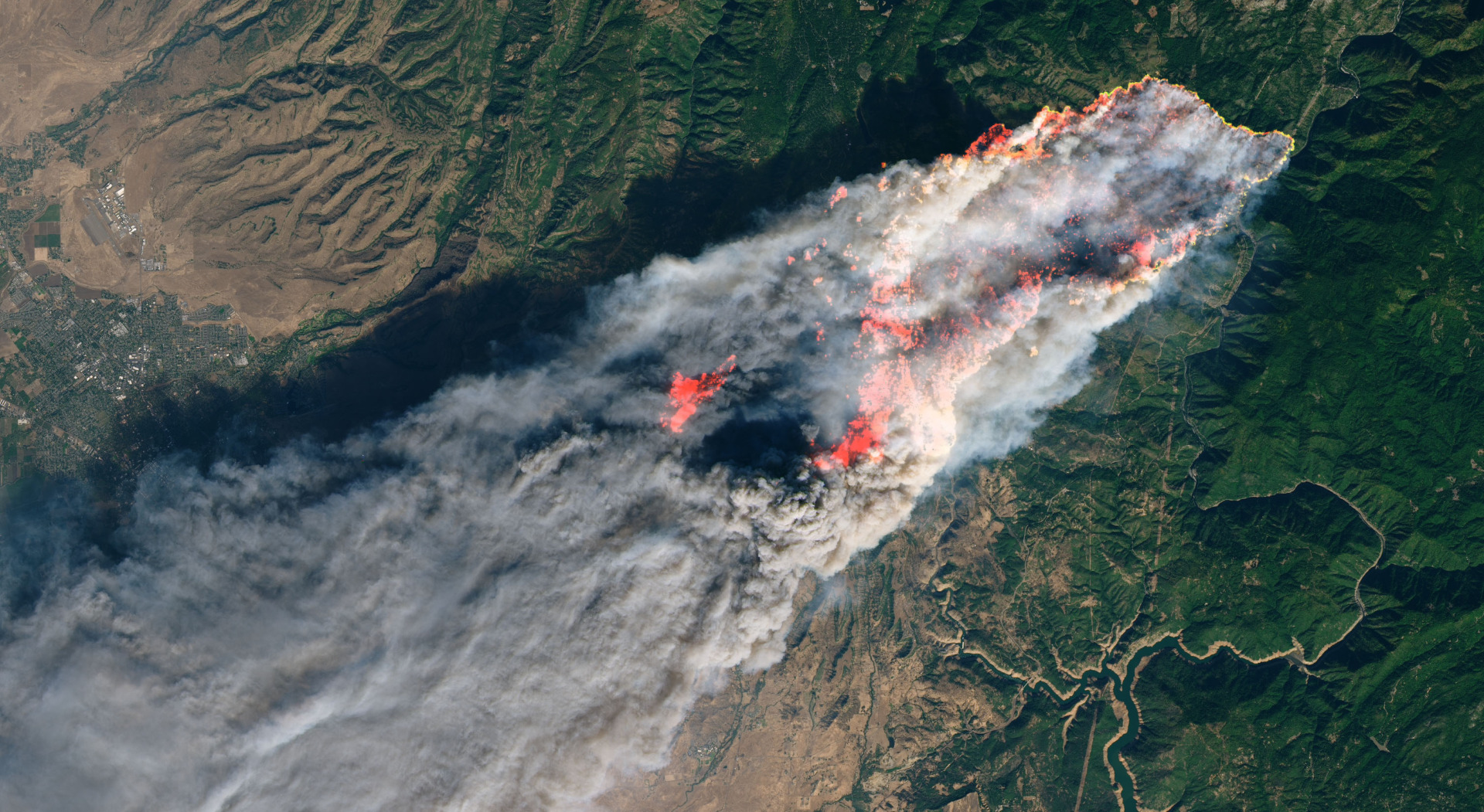
Extreme weather events are multiplying. Heatwaves and droughts have already triggered devastating wildfires across the U.S., which is enduring one of its worst wildfire seasons in years, while Europe has faced its own share of destructive blazes. And looming over all of it: the possibility of one of the strongest El Niño events on record — a force that could intensify every climate disaster simultaneously. We’ve made real advances in the science and tools to protect communities. But our strategies for using them haven’t kept pace with the scale of what’s coming. We’re fighting 21st-century climate disasters with outdated, reactive strategies when we can anticipate them.
Entering a high-risk summer, we need to shift from thinking “what happened?” to “what’s likely to happen?” From reactive emergency response to proactive community planning. From recovering after the devastation to making informed choices. The question isn’t whether climate disasters will affect your community; it’s when, and whether you’ll have enough warning to protect what matters. We need to build resilient communities where the next generation can safely put down roots.
As someone working at the intersection of Earth science, geospatial data, and Artificial Intelligence (AI), I’ve seen how dramatically our ability to anticipate risk has improved.
The good news? We already have much of the science and many of the technological building blocks to do it. The work I’ve focused on for years is integrating geospatial data into advanced AI systems trained on satellite imagery and Earth observation data. This is not about replacing numerical weather prediction models — but about augmenting them with learned representations of land, infrastructure, and exposure.
Much of the data communities need for proactive Earth modeling is fragmented across federal agencies: NOAA has weather data, NASA has satellite imagery, and USGS has ground sensors. But they don’t talk to each other in ways that can support local departments and governments. With accurate, accessible data, we can shift from reacting to disasters to being prepared for them, when paired with appropriate decision frameworks, uncertainty-aware models, and institutional capacity.
Many commercial companies are racing to build large-scale geospatial foundation models optimized for mapping, monitoring, and downstream inference — not community risk reduction. As a result, these proprietary systems rarely prioritize equitable community protection or broad public access. With fragmented data and siloed technology, communities are still forced to wait for disaster to strike, then scramble to react.
We need open-source foundation models for geospatial AI — a shared public infrastructure for weather and climate intelligence. These models would be trained on comprehensive Earth observation data, informed by outputs from physical weather models, and designed so that anyone can use them.
In recent years, I’ve led research on geospatial foundation models for Earth observation through a partnership with NASA, IBM, and Clark Center for Geospatial Analytics.
These models have already been used by researchers worldwide to improve land cover mapping, flood extent detection, wildfire monitoring, and agricultural monitoring across multiple regions. This is the blueprint: public-private partnerships where tech companies contribute resources; universities tackle hard research questions; and federal agencies like NOAA, NASA, and USGS coordinate development and share their data in usable formats.
The stakes couldn’t be higher: disaster-related damages cost an estimated $2.3 trillion globally each year, while billion-dollar disasters in the United States are growing in both frequency and severity.
We see this impacting costs everywhere: insurance rates are climbing, property values are declining in high-risk areas, and food prices are rising with each drought.
Access to real-time geospatial data is critical for forward-thinking planning — it enables communities and governments to predict environmental changes, model climate impacts, and allocate resources proactively rather than reactively. This shift from crisis response to preparedness planning can mean the difference between manageable challenges and catastrophic losses. Building open geospatial AI models is essential to making this kind of anticipatory planning possible at scale.
The return on investment is clear: research from Allstate, the U.S. Chamber of Commerce, and its Foundation shows that every dollar spent on climate resilience and preparedness saves communities $13 in damages, cleanup costs, and economic losses. Even when disasters don’t strike, communities still reap economic benefits from being prepared.
Related Articles
Here is a list of articles selected by our Editorial Board that have gained significant interest from the public:
What this could look like in practice: fire risk maps updated daily and available to any fire department, not just wealthy counties that can afford outside support. Drought predictions accurate enough for farmers to shift their planting schedules before it’s too late. Flood forecasts down to the neighborhood level, so families know whether to buy sandbags or move to higher ground. Insurance companies and developers making decisions based on real risk; not outdated models built on pre-climate-change assumptions.
Compare the investment needed to build open models against the losses we’re already experiencing. The infrastructure for these AI models largely exists — we’re talking about coordination and open access, not building from scratch. Yes, progress is happening, but primarily in silos. NASA has the data. Big tech has the AI. Local infrastructure like fire departments have the need. They’re not connected, and proprietary models are not serving all communities.
Companies, researchers, agencies, and local departments must work together to close the gap, so together we can build out these open AI geospatial systems that serve everyone.
As we enter a high-risk wildfire season, more than 46 million individuals in 72,000 communities across the United States remain vulnerable. For future climate disasters, we have a choice: remain reactive or build the open systems that give communities the time they need to protect themselves.
The science and technology are no longer the primary limiting factors; we can already forecast climate risks with increasing accuracy. The question is whether we will organize and share those capabilities in ways that meaningfully reduce loss and destruction. As climate extremes accelerate, the difference between prediction and preparedness will increasingly determine which communities recover — and which ones don’t.
Editor’s Note: The opinions expressed here by the authors are their own, not those of impakter.com