It is hurricane season, and as hurricane Florence is approaching very fast the US east coast threatening states including Virginia, North Carolina, South Carolina and Georgia it is very useful to take a look at the best apps available for your smart phone that will alert and help you keep an eye on the incoming bad weather. Beside using this apps, it is always a good idea to listen to the local government and follow without doubts all the instructions and any eventual order of evacuation.
Why should you use this app, here the Weather Forecast Channel explains it well with this frightening video simulation of a 9Ft (2.74meters) storm surge like the life threatening one from a Hurricane Florence..
American Red Cross App
Available both on iOS and Android operated smart phones, it is one of the free apps the American Red Cross has released to help the population in case of natural disasters. The others include a general emergency app, a tornado app, an earthquake and a flood app.
The American Red Cross app is available in English and Spanish and it tracks the current storms, as well as it predicts which path they could follow. Alerts are available to monitor both your area, and the areas where people you care live. There are also push notifications including an “I’m safe” alert button connected to your social media to let others know you are safe.
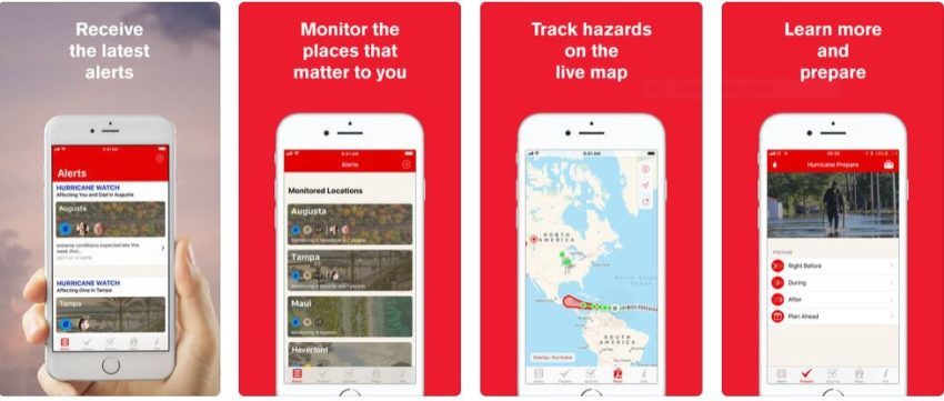 In the photo: The American Red Cross App. Photo Credit: American Red Cross
![]()
![]()
Hurricane Hound
Hurricane Hound is a free app currently available for Android. It uses US radars and it covers most of the Atlantic and East coast area.
It tracks hurricanes on a Google Maps background. Showing both tracks of current hurricanes and the forecasts of tropical storm possibly turning into hurricanes. It also highlights on the map the areas where the National Weather Service (NWS) is watching for possible development of other storms.
![]()
Hurricane Tracker
Available for both iOS and Android, this app which cost 3.99 $ is one of the most downloaded on the market. Push Alerts as well as discussion and analysis from the Hurricane Tracker Team are available.
The app receives updates from the National Hurricane Center but it enables users to customize them by setting different levels of alert. All the information available on the app can be shared easily through social networks, emails, or text messages.![]()
In the photo: The Hurricane Tracker app. Photo Credit: The Hurricane Tracker.
![]()
![]()
My Hurricane Tracker & Alerts
Free and available on iOS and Android, My Hurricane Tracker gives you tools to track hurricanes, tornados, cyclones, tropical storms.
Warnings and push notifications are available as well. The interactive maps help you tracking all the hurricane. The historic research allows you to see the past storms. You can also receive the warnings from the national weather service and an outlook from the National Oceanic and Atmospheric Administration.
![]()
![]()
NOAA SuperRes Radar US – HD Weather Radar and Forecasts
This app is designed for real “weather forecast enthusiasts”. Available for $3.99 on iOS, it offers access to hi-resolution radar mosaics for the continental US, which are both very accurate and easy to use. No other app offers similar super detailed images.
Warnings are available however those are not push notification and the app must be open otherwise it is not possible to receive them.
While the GPS locator enables the app to find your current location, unfortunately the radar coverage only includes continental United States.
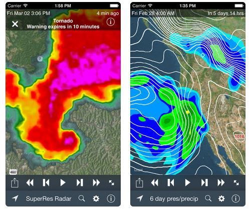
In the photo: The NOAA SuperRes Radar US – HD Weather Radar and Forecasts. Photo Credit: NOAA SuperRes Radar US – HD Weather Radar and Forecasts. Available here:
![]()
Storm Radar
Storm Radar app by the world famous Weather Channel features an HD interactive map. It is available for both iOS and Android. It does have ads unless you pay 0.99 $ per month to obtain an ad free version. Hurricanes and storms paths are colored on the map and it is possible to see exactly where the storm will be in six hours. It tells you the wind speed too.
Notification based on your GPS position are available for Hurricanes as well as other severe weather event including tornadoes, storms and lightning.
![]()
![]()
Ventusky
Ventusky is not just a hurricane tracking app. It does track all the winds around the globe instead so it does include hurricanes as well. Ventusky’s name is a combination of two words. The first is the Latin word, Ventus, means wind, and the second is the English word, Sky.
Available for free both on iOS and Android and created by a team based in the Czech Republic, Ventusky aims to show how the weather on earth works as an interdependent system. This means that potentially a hurricane hitting the US east coast could lead to a weather change in other areas like Europe. The map shows several things including wind direction and speed, temperature, waves and humidity and is really easy to understand.
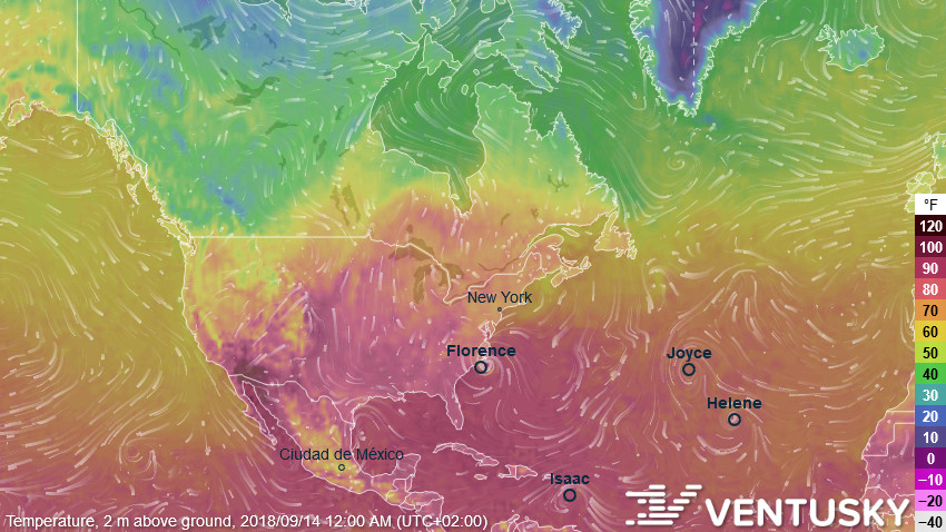
In the photo: Ventusky app. Photo Credit: Ventusky.
Do you have other favorite apps to track hurricanes and the weather in general? Let us know!
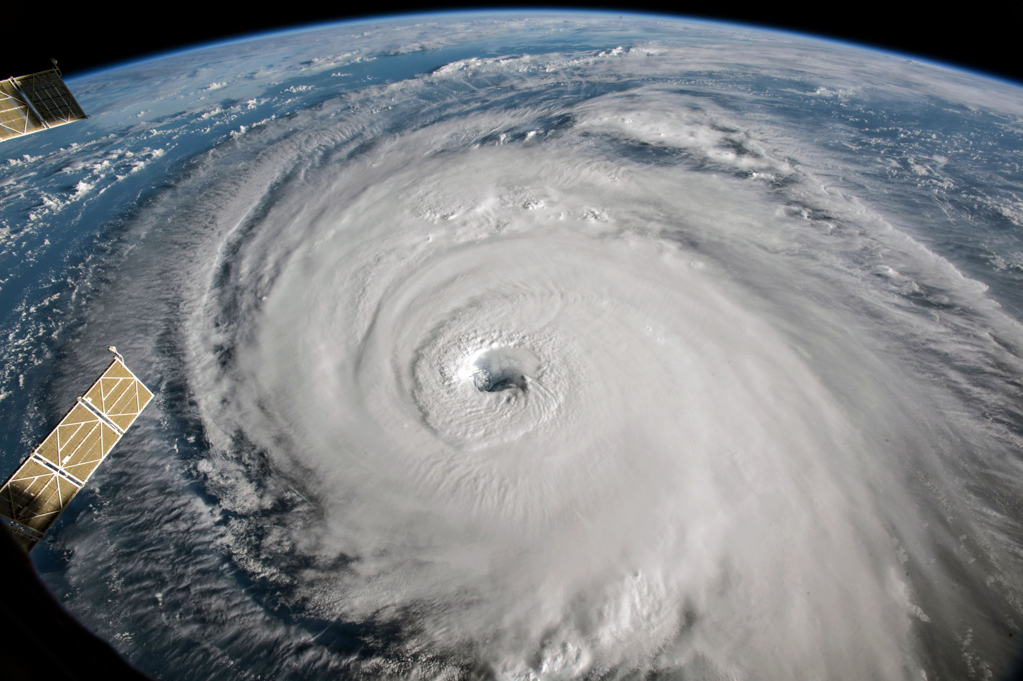
In the cover photo: An Hurricane about to hit the US east coast. Photo Credit: Wikipedia.
EDITOR’S NOTE: The opinions expressed here by Impakter.com columnists are their own, not those of Impakter.com Cover image: A view of Hurricane Florence is shown churning in the Atlantic Ocean in a west, north-westerly direction heading for the eastern coastline of the United States, taken by cameras outside the International Space Station, September 12, 2018. NASA/Handout via REUTERS